

Measure This! xyHt Podcast
Gavin Schrock and Zach discuss how drone data has been applied to real world AEC projects. The podcast is full of real world tips you can a


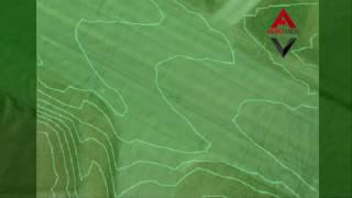
Capturing Pre-Flood Conditions
The ability to compare pre-flood to post flood conditions is invaluable in the planning process for future high water events. Optimized pla


Airware
AeroView has been the go-to choice for CUSTOM drone data processing since 2015. We can work with photos from any drone, with or without geo

Fazenda de Toca Visit
We were fortunate to have the folks from Fazenda da Toca stop by our office today. They were interested in how they can use the latest...
Simplify Work
A short video showing how UAV data can be transformed into a CAD compatible surface accurate within 0.1′ in the Z-axis.


Intelligent Aerospace
Aeroview Services made the news again – this time one of our projects was featured in Advanced Aerospace magazine.


Sustainable Agriculture Meets High Technology
AeroView is using 3D data generated from our UAV flights to help make sustainable farms more efficient – from drainage to tree layouts. ...


Caterpillar’s Digital DNA – Drones
Caterpillar is making big moves into developing actionable intelligence from drone data. It is going to take integration from the big...


Why Do You Require Ground Control?
One of our most common client questions is “ Why do you need a surveyor to measure ground control? So and so said they don’t need it for...


