

Measure This! xyHt Podcast
Gavin Schrock and Zach discuss how drone data has been applied to real world AEC projects. The podcast is full of real world tips you can a


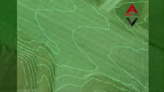
American Flat Track
AeroView utilized the latest drone technology to topo the Peoria Motorcycle Club's track. There is no better way to capture ALL of the


Capturing Pre-Flood Conditions
The ability to compare pre-flood to post flood conditions is invaluable in the planning process for future high water events. Optimized pla


"Above the Mud" xyHt Feature Article
Drone data utilized in design and bidding for a lake remediation project.


Airware
AeroView has been the go-to choice for CUSTOM drone data processing since 2015. We can work with photos from any drone, with or without geo

Fazenda de Toca Visit
We were fortunate to have the folks from Fazenda da Toca stop by our office today. They were interested in how they can use the latest...
Simplify Work
A short video showing how UAV data can be transformed into a CAD compatible surface accurate within 0.1′ in the Z-axis.


Trimble technology&more Magazine
Mike Meixler’s golf course redevelopement project in Concho, AZ is popular with the press. Trimble’s technology&more magazine ran the...


xyHt Magazine
AeroView’s unique ability to put UAV data to work in Civil Engineering was featured in this month’s xyHt magazine.


Canada Special Flight Operations
Transport Canada has authorized AeroView Services, through their Special Flight Operations Certificate (SFOC) process, for commercial...


